Arizona’s Superstition Mountains are steeped in lore, intrigue, and mystery.
Article and Photos by Kent & Charlene Krone
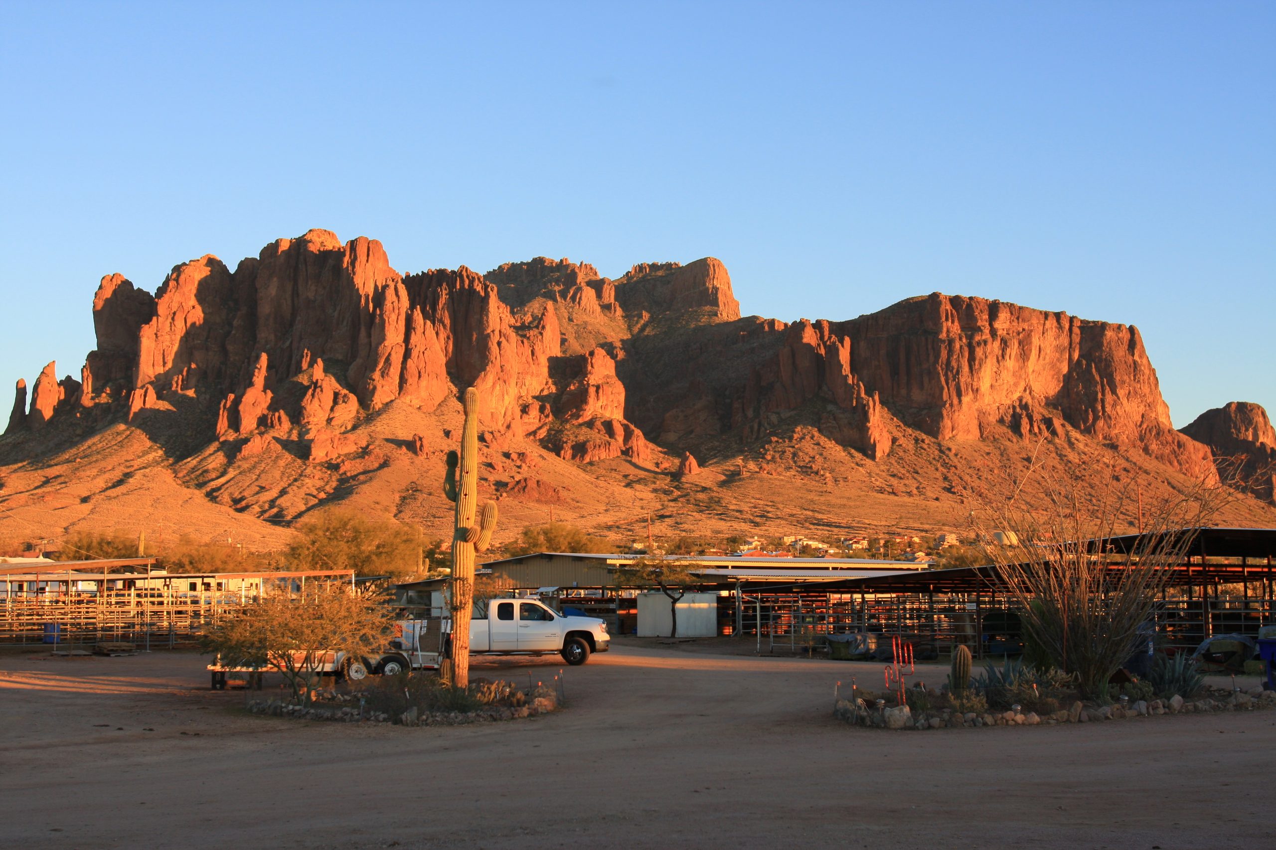
Few mountain ranges are as steeped in lore, intrigue, and mystery as the Superstition Mountains, located northeast of Phoenix in the Superstition Wilderness Area, which encompasses 160,200 acres of the 4,489-square-mile Tonto National Forest. Equestrian adventurers are drawn to this rugged area to ride and camp with their horses, and photograph the mountains’ ruthless beauty.
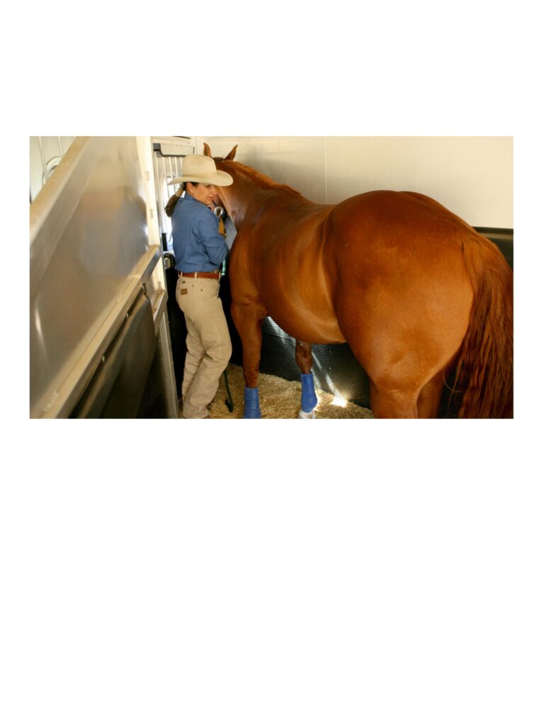
The best time to ride and camp in this area is November through March to avoid the area’s searing heat. We headed there one February and camped with our Missouri Fox Trotter geldings, Nate and Cowboy. We stayed in our living-quarters trailer at King Stable in Apache Junction.

Lost Dutchman Gold Mine
Prehistoric indigenous people once made their home in the Superstition Mountains. Petroglyphs, pottery shards, and small cliff dwellings from as long ago as 800 A.D. are evidence of their past existence.
By the late 1800s, ranchers and miners settled in the area. Ranchers supplied beef to the military and nearby towns, while miners searched for precious metals. Several mines are still in operation today.
The most famous mine in the Superstition Mountains was the Lost Dutchman Gold Mine. Legend has it that the Peralta family of Sonora, Mexico, developed several mines. These were later “rediscovered” by Jacob Waltz, an itinerant mine laborer and German immigrant.
Waltz later became known as The Dutchman, a common American term for a person from Germany; the term is derived from “Deutsch,” the German word for German. People have been trying to find the Lost Dutchman’s gold mine for 100 years; many have died trying.

Hackberry Spring
A great introductory ride into the Superstitions is the trail to Hackberry Spring and Garden Valley. For direct access to Hackberry and Garden Valley, drive to the First Water Trailhead, located 5.6 miles northeast of Apache Junction on State Route 88, between Mileposts 201 and 202. Turn right off Route 88, and drive 2.6 miles to the First Water Trailhead parking lot.
We rode from the northeast corner of the parking lot, into a ravine, and turned left onto a trail that curved uphill. At the top, we paused to give our horses a breather and take in the gorgeous scenery. Then we checked our cinches for the steep downhill portion of the trail.
We rode what’s called the Dragon’s Backbone down into a draw and directly into Hackberry Spring. This is a special place. Just leave hoofprints, and take memories.
The spring sits in a shady canyon with sheer, colorful cliffs rising a couple hundred feet on one side. There’s generally water at the base of the cliff. The canyon floor is carpeted with velvet-green grass and canopied with trees.
After a good rest, we rode past the spring and uphill to a fence opening and worked our way up to Garden Valley. The large, flat Garden Valley is filled with mesquite trees and chain fruit cholla. We continued on down and out the valley to the First Water Trailhead parking lot.

The Dutchman’s Trail
On a crystalline mid-February morning, we rode an approximate 10-mile Dutchman Trail/Black Mesa loop. Once again, we used the First Water Trailhead. This is a beautiful, albeit rocky, ride in the Superstition Wilderness Area. There’s a great deal of brittle, volcanic rock, and the soil layer is thin.
We began our ride with plenty of water, packed lunches, and high spirits. It’s always fun to do a new ride; we hadn’t ridden this loop before.
In less than half a mile, we came to the boundary of the Superstition Wilderness Area, a desolate, ruthless, hauntingly beautiful expanse that has lured many hopeful dreamers to untimely deaths.
Trail names here remind us of the lost-gold mystery. Did Jacob Waltz, the Dutchman, leave his cache of gold nearby? Pondering that thought, we turned right onto the Dutchman’s Trail, a rocky, four-mile pull to Parker Pass. From the trailhead to the pass, we gained 900 feet in elevation and took in glorious scenery.
We followed the trail down the pass and came to our next intersection, Boulder Flat. From here, we could easily see Weaver’s Needle, a prominent landmark. Folklore says that once a year the shadow of Weaver’s Needle crosses the site of the Lost Dutchman Gold Mine.
After lunch, we turned left and headed up a steep, rocky hill that we followed for three miles. To our right, we could see Black Mesa, a thin layer of black volcanic rock atop tan cliffs.
At the end of three miles, we reached another trail junction and turned left. In 1.5 miles, this connects with the Dutchman’s Trail, which leads right back to First Water Trailhead parking lot.

Lost Goldmine Trail
The Lost Goldmine Trail’s panoramic beauty springs from its proximity to the Superstition Mountains, the varied maze of cacti, and abundant wildflowers. Amarillo brittlebush dots the desert floor; fluffy, scarlet blossoms perch atop staghorn cactus like festive Easter hats.
To find the trailhead to the Lost Goldmine Trail, turn north off U.S. Route 60 onto King Ranch Rd., then drive a couple miles to the Hieroglyphic Trail parking lot. From the north end of this lot, you can ride the Lost Goldmine Trail east.
On the first several miles of this trail, we had a visual feast of mountains on our left, undulating flats on our right, and diverse plant life all around. Nearing our turning point, we checked out a verdant copse of palo verdes and led the way.
Suddenly there was a loud “woof!” A large mass sprang out of the brush, scaring horses and riders alike. It was an enormous javelina, its face streaked with white bristles.
This ride can be made into a loop by turning across the valley to the right and heading to the first ridge a short distance away. A trail following this ridge heads in a southwesterly direction.
At the end of the ridge, we followed a trail to the right to the parking lot we started from. Shortly before we arrived at the parking lot, we spotted a great horned owl asleep in a croft of a saguaro cactus. A perfect ending!

Coffee Flat Trail
The Peralta Trailhead is located just a few miles east of the turnoff for the Lost Goldmine Trail. We headed out on the Coffee Flat loop.
Not realizing they were in for a long, hot ride, our horses eagerly headed out of the parking lot and straight uphill. We turned right on Dutchman’s Trail (#104) and rode the 2.6 miles to the Coffee Flat trail. Interesting rock formations towered nearby.
We reached the Coffee Flat trail and turned right. After several miles, we came to a gate. We took a quick left and rode to a lonely windmill amid feathered greenery. This was our long-awaited lunch spot.
We made ride a loop by continuing a mile down the basin to a second gate and small road. We turned right on this road, then went through another gate and back to Coffee Flat Trail.